Vereda do Pico do Suna is a rewarding, little-known mountain walk in eastern Madeira, not a route above São Vicente. It lies in the parish of Porto da Cruz, close to Santo António da Serra, where steep forested slopes open towards Madeira’s central peaks and the Atlantic. In this updated guide: learn what the route is like, how to approach its less-obvious logistics, what conditions to check and how to build it into a quieter east-coast day out.
What is Vereda do Pico do Suna?
Vereda do Pico do Suna Madeira is best understood as a local highland route rather than one of the island’s heavily promoted, signposted PR walks. The Pico do Suna eco-site sits above Porto da Cruz, beside the Laurissilva forest and close to the boundary with Santo António da Serra. It is a wild-feeling landscape of ridges, woodland and broad views rather than a polished visitor attraction.
The route is particularly appealing if you have already walked Madeira’s better-known trails and would like a day with fewer people. On a clear day, the outlook takes in Santana, Penha d’Águia, Porto da Cruz, Ponta de São Lourenço and the central mountain chain, including Pico Ruivo. The sense of space is the real reward: this is a place to slow down, listen to the wind in the trees and watch cloud move across the high ground.
It is also worth being precise about the geography. Pico do Suna is in eastern Madeira, within Porto da Cruz parish in the municipality of Machico; it is not in São Vicente on the north-west side of the island.
Route, distance and what to expect underfoot
The municipality’s Pico do Suna eco-site information describes a 5.5-kilometre route between Lamaceiros and Caminho da Terra Baptista. It crosses a large elevation range, from 285 metres to 1,027 metres, so it should not be mistaken for an easy stroll simply because the overall distance is modest.
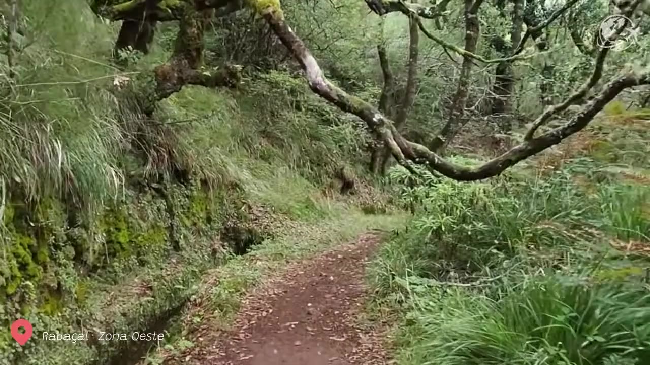
Expect a mixture of rural lanes, forest tracks and uneven earthen paths. Sections can be steep, especially after rain, when soil, leaves and loose stone become slippery. The route is more satisfying for confident walkers who are comfortable on rough ground and who can judge when conditions have become unsuitable.
Navigation deserves attention. This is not a simple follow-the-waymarks hike with the infrastructure of the busiest official PR routes. Download an offline map before leaving coverage, carry a fully charged phone and treat any confusing junction as a reason to stop and confirm your position rather than pressing on. Avoid relying on a route trace alone: vegetation, storm damage and forestry work can change the practical character of a path.
| Area | Porto da Cruz, eastern Madeira, near Santo António da Serra |
| Route listed locally | Lamaceiros to Caminho da Terra Baptista |
| Distance | 5.5 km |
| Altitude range | 285 m to 1,027 m |
| Terrain | Forest tracks, rural access lanes and steep, uneven earth paths |
| Best for | Independent, experienced walkers seeking quieter mountain scenery |
| Official status | Not listed as a classified PR walking route |
| Starting reference point | 32°44′15.85″N, 16°51′13.52″W |
How to get there and organise the logistics
A car is the most practical way to reach Pico do Suna. Public-transport connections are not designed around this particular route, and the two ends are not conveniently linked for a spontaneous point-to-point walk. If you are travelling without your own vehicle, arrange a taxi drop-off and collection in advance, or hike with a local guide who knows the access points.
Because the route runs between separate areas, decide before setting out whether you are walking it one way with a second vehicle or taxi transfer, or making a shorter out-and-back exploration from a safe access point. Do not leave a car where it blocks a narrow lane, agricultural entrance, forestry track or private access.
There is no visitor centre at the summit and no dependable refreshment stop on the trail itself. Bring enough drinking water, a packed lunch and an extra layer. Mobile signal can be weak or intermittent in the folds of the terrain, especially away from open ridges.
For visitors who depend on buses and transfers, our guide to Madeira hikes without a car explains the planning principles that matter most on less-served trailheads.
Cloud, rain and route conditions: check before you go
Pico do Suna’s height is part of its appeal, but it also brings rapidly changing conditions. Low cloud can remove every view within minutes, while wind and drizzle make the steepest ground far more demanding. Even when Porto da Cruz is warm and sunny, the upper route may be cold, wet and misty.
Start early enough to give yourself a generous margin before dusk. If cloud becomes dense enough that you cannot confidently identify junctions or terrain ahead, turn around. This is not the place to improvise a descent through unfamiliar woodland.
The Madeira forestry authority, IFCN, publishes live information for classified PR trails, but it does not maintain or provide safety responsibility for every path on the island. Pico do Suna is not included in the official classified-route list, so there is no equivalent official open-or-closed status page for this exact walk. Check the IFCN trail notices for wider weather, fire-risk or access restrictions affecting nearby mountains, then make a local judgement at the trailhead.
For a realistic idea of rain, wind and visibility by season, read our Madeira weather by month guide before choosing your hiking day.
What to combine with Pico do Suna
On a clear morning, combine the hike with Portela Viewpoint, where the eastern valleys and Penha d’Águia make a dramatic contrast to Pico do Suna’s wooded slopes. Afterwards, descend towards Porto da Cruz for a meal or coffee by the sea, or continue to Machico if you want a gentler coastal finish.
Strong walkers can also look at the official PR 10 Levada do Furado, which runs from Ribeiro Frio to Portela. It is a separate, classified 11-kilometre route and requires advance booking and the applicable access payment through the official system. Do not assume that a route which passes near Pico do Suna is automatically included in PR 10, or that the conditions and access arrangements are the same.
If you prefer another quiet high-altitude stop on a different day, Pico da Urze offers a very different landscape near Paul da Serra, with easier road access and expansive plateau views.
Insider tips for walking Pico do Suna
- Choose visibility over convenience: a clear forecast matters more here than simply having a free afternoon.
- Use proper hiking footwear: grippy boots or trail shoes are far safer than trainers on damp earth and loose stone.
- Plan a one-way solution first: confirm your second car or taxi collection before committing to the full route.
- Carry an offline map: do not expect continuous mobile coverage or comprehensive trail signage.
- Pack for the summit, not the coast: add a waterproof shell and warm layer even if Porto da Cruz begins the day in sunshine.
- Respect working countryside: close gates, keep clear of agricultural access and leave no litter in this sensitive mountain environment.
Frequently asked questions
Is Vereda do Pico do Suna an official PR trail?
No. Pico do Suna is not listed among Madeira’s classified PR walking routes. That means it does not have the same official route status, maintenance framework or live trail-status listing as a managed PR walk.
How long is the Vereda do Pico do Suna route?
The local Pico do Suna eco-site lists a 5.5-kilometre route between Lamaceiros and Caminho da Terra Baptista. Allow extra time for route finding, steep ground and stops for views.
Is Pico do Suna suitable for beginners?
It is better suited to walkers with some mountain experience. The distance is not long, but the altitude range, uneven terrain, steep slopes and changing weather make it more serious than an easy levada walk.
Can I hike Pico do Suna in cloudy weather?
It is possible only if you are confident in navigation and conditions are otherwise safe, but it is not recommended for first-time visitors. Cloud can hide paths and remove the panoramic views that make the route special.
Facts and prices verified in October 2026. For more route planning, see our guides to hiking Madeira without a car, Madeira weather and hiking conditions and Encumeada’s mountain walks and driving conditions.