The Ponta do Clérigo hike is a steep, little-known coastal walk on Madeira’s north coast near Santana and Faial — not in the south-west near Fajã da Ovelha or Ponta do Pargo. It leads from the Levada do Cortado area down towards a dramatic Atlantic headland, with far-reaching views across the rugged coast towards Penha d’Águia and, on clear days, the eastern end of the island. In this updated guide: learn where the route starts, which direction makes most sense, why the return climb is demanding, how to plan transport, and what to check before setting off.
What is the Ponta do Clérigo hike?
The Ponta do Clérigo hike is an informal out-and-back walk in the municipality of Santana, close to the boundary with Faial. It is sometimes described online as a levada walk because its opening section follows the Levada do Cortado, but the main experience is a descent through rural land and rough tracks to a lonely coastal promontory.
This is not one of Madeira’s classified PR walking trails. That matters: it does not have the maintained waymarking, formal booking system or published open/closed status attached to official PR routes. The official Madeira hiking network currently requires advance booking for classified PR trails, but Ponta do Clérigo is outside that network.
The reward is a much quieter side of Madeira. Rather than a polished viewpoint or a busy levada path, expect agricultural terraces, a narrow levada section, broad Atlantic exposure and an abrupt sense of being above the sea. It is a good choice for confident walkers who have already enjoyed busier coastal routes such as the Vereda do Larano and want something more remote.
Route direction: descend first, then earn the return
Most walkers start near Cortado, above the north coast, and walk downhill towards Ponta do Clérigo before returning by the same route. This is the sensible direction: the best coastal views gradually open in front of you, and there is no uncertainty about how to get back to your car.
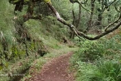
The first section follows the Levada do Cortado and includes a short, unlit tunnel. A torch is useful here; a phone light is workable, but not ideal if you are carrying poles or need both hands free. Beyond the levada, the route becomes less obvious, descending on tracks and uneven paths towards the headland. Mapping platforms describe variations of roughly 5.8 to 6.6 km return, with a substantial descent followed by the same ascent back to the start.
Do not underestimate that final point. The outward walk can feel straightforward because it is mostly downhill, but the return is sustained and steep. Allow extra time for pauses, particularly in warm weather. This is not the place to rush because you have a restaurant booking in Funchal.
| Practical fact | What to know |
|---|---|
| Area | Cortado, Santana/Faial, on Madeira’s north coast |
| Route type | Unofficial out-and-back walk to Ponta do Clérigo |
| Distance | Approximately 5.8–6.6 km return, depending on the tracked variation |
| Time to allow | About 3–4.5 hours, including the steep return climb |
| Difficulty | Challenging: steep ascent on the return, uneven ground and exposed sections |
| Tunnel | Short and unlit on the Levada do Cortado section; bring a torch |
| Trail fee | No PR access fee applies, as this is not a classified PR trail |
| Best transport | Hire car or pre-arranged taxi; public-transport connections are limited |
What to expect on the trail
Scenery, rather than technical hiking infrastructure, is the reason to come. The route looks over the green, deeply folded north coast, where cultivated slopes fall rapidly towards dark volcanic cliffs. At Ponta do Clérigo, the headland gives a striking perspective along the shore; Penha d’Águia is one of the most recognisable landmarks in the distance when visibility is good.
Underfoot conditions can change quickly. Parts of the route are on levada-side paths and vehicle tracks, while the descent to the coast is steeper and can be slippery after rain. There are no facilities at the headland, so carry enough water, food and anything you may need for the full walk.
Although the north coast is generally greener and can be cooler than the sunny south-west, do not mistake it for shade. Large portions of the descent are open to the sky. In summer, start early; in unsettled weather, fog can move in quickly and remove the views that make this walk worthwhile.
How to get to the Ponta do Clérigo trailhead
A car is the practical option. Drive towards Santana and follow local roads to the Cortado area, where the start is near a small tunnel used by the levada. Parking is informal and limited, so do not block access roads, farm entrances or turning areas. The start can feel surprisingly unremarkable, which is why an offline map and downloaded route are sensible.
Public transport is not a reliable solution for this particular walk. Bus services connect larger settlements, but they are not designed around the Cortado trailhead or a late-afternoon return after a hike. A taxi can work if arranged both ways, but mobile signal may be inconsistent once you are lower on the route.
If you are building a self-drive day around the area, combine it with Faial’s viewpoints or the coast around Santana rather than attempting to cross the island afterwards. For wider route-planning advice, see our guide to renting a car in Madeira.
Safety, weather and official status checks
Because Ponta do Clérigo is not an official PR route, there is no dedicated official status label saying that it is open or closed. That does not mean conditions are automatically safe. Landslips, overgrowth, saturated ground and local access issues can affect informal paths without appearing on a standard hiking map.
Check the official Visit Madeira hiking page and IFCN notices before leaving, especially after heavy rain, strong wind or periods of unstable weather. These sources publish the current situation for classified routes and broader trail alerts; use them alongside a local weather forecast and your own judgement. The IFCN specifically warns that erosion and weather exposure can affect Madeira’s walking routes.
- Start early: the return ascent feels much harder in midday heat, even on Madeira’s greener north coast.
- Take a proper torch: the short levada tunnel is unlit, and keeping your hands free is safer than relying on a phone.
- Download your map: this is an unofficial route, so do not expect continuous signs or dependable mobile coverage.
- Wear grippy footwear: loose earth, damp stone and uneven tracks are more common here than on a maintained promenade-style trail.
- Carry more water than usual: there are no cafés, taps or services once you leave the road.
- Turn back without hesitation: low cloud, strong wind, fresh slips or uncertainty on the descent are good reasons to abandon the walk.
Frequently asked questions
Is Ponta do Clérigo in south-west Madeira?
No. Ponta do Clérigo is on Madeira’s north coast in the Santana/Faial area. It should not be confused with walks near Fajã da Ovelha, Ponta do Pargo or Paul do Mar in the south-west.
Is the Ponta do Clérigo hike an official PR trail?
No. It is an informal route, so it does not have the formal PR reservation requirement, designated trail status or guaranteed signage associated with Madeira’s classified walks.
How hard is the Ponta do Clérigo hike?
It is challenging rather than technically difficult. The key challenge is the steep descent to the coast followed by a sustained uphill return on uneven ground.
Can I do this hike without a car?
It is possible only with careful taxi planning, but a hire car is much more practical. Bus connections do not conveniently serve the Cortado starting area or provide a dependable hiking-day timetable.
Facts and prices verified in August 2026. For a contrasting easy levada day, read our Levada do Alecrim guide; for more dramatic north-coast scenery, see Porto da Cruz; and for a practical driving plan, use our Madeira in 7 Days by Car itinerary.