The Pico Ruivo Achada do Teixeira PR1.2 hike is the shortest official walking route to Madeira’s highest summit, at 1,862 metres. Starting from the high plateau at Achada do Teixeira, it gives walkers a realistic way to reach Pico Ruivo without committing to the longer mountain traverse from Pico do Areeiro. In this updated guide: how to drive to the trailhead, where to park, what the route feels like, the 2026 access fee, and why checking the official trail status is essential before setting off.
Why choose PR1.2 from Achada do Teixeira?
PR1.2, officially named Vereda do Pico Ruivo, is the practical choice for travellers who want to stand on Madeira’s highest point but have limited time, do not want to arrange a one-way mountain crossing, or prefer to return to the same car park. The route begins at Achada do Teixeira, in Santana municipality, and runs for 2.8 km each way, making a 5.6 km out-and-back hike. The official walking estimate is around 1 hour 30 minutes, although allowing two to three hours gives you time for photographs, breaks and changing conditions at the summit.
This is still a proper mountain walk rather than a casual viewpoint stroll. Achada do Teixeira sits at roughly 1,592 metres, while Pico Ruivo reaches 1,862 metres, so expect an overall climb of about 270 metres, including a more demanding final ascent towards the shelter and summit area. The reward is an extraordinary high-altitude landscape of ridges, valleys and volcanic peaks, often with cloud drifting below the trail.
Driving to Achada do Teixeira and parking
Achada do Teixeira is reached by road from the north of Madeira, above Santana. The approach uses the ER218, which links Santana with the Achada do Teixeira plateau; this is a scenic mountain drive with frequent bends and occasional low cloud. A hire car is the simplest option, particularly if you want flexibility around the weather and an early start.
There is a designated parking area at the Achada do Teixeira trailhead, shown on the official PR1.2 route information. Arrive early in clear weather, at weekends, and during holiday periods: this is one of Madeira’s most popular mountain access points, and spaces can fill quickly. Before starting the hike, look for the nearby basalt formation known as Homem em Pé, or Standing Man.
| Official route | PR1.2 – Vereda do Pico Ruivo |
| Start / finish | Achada do Teixeira / Pico Ruivo, returning by the same route |
| Distance | 5.6 km return |
| Official duration | About 1 hour 30 minutes return |
| Difficulty | Moderate |
| Highest point | Pico Ruivo, 1,862 m |
| 2026 access fee | €10.50 for the full PR1 access ticket for visitors aged over 12; children aged 12 and under are exempt |
| Access | Drive via the ER218 from Santana; parking is available at Achada do Teixeira |
What the Pico Ruivo Achada do Teixeira PR1.2 hike is like
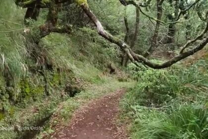
From the trailhead, PR1.2 follows the high ground below the central mountain massif. The scenery opens quickly: look towards Santana and the north coast on one side, and towards deep interior valleys and jagged peaks on the other. The path passes several small shelters and former refuge points, reflecting how quickly the weather can turn in this exposed part of Madeira.
The final approach reaches Casa de Abrigo do Pico Ruivo, the mountain shelter below the summit. This is the junction for other major routes, including PR1 towards Pico do Areeiro and PR1.1 down towards Ilha. From the shelter, continue uphill for the short final section to the summit viewpoint. On a clear day, the outlook can extend to Ponta de São Lourenço, Paul da Serra, Porto Santo and the Desertas Islands; on cloudy days, the experience may be limited to mist, wind and a dramatic sea of cloud.
Do not assume that a clear morning on the coast means clear conditions at 1,800 metres. Take a waterproof outer layer, a warm insulating layer, water, snacks, sun protection and footwear with reliable grip. The temperature and wind can feel markedly different from Funchal, even in summer.
Trail fee, booking and current route status
Madeira’s classified walking routes operate under a paid-access and reservation system. In 2026, the full PR1 ticket costs €10.50 for visitors over 12 and includes PR1, PR1.1, PR1.2 and PR1.3 where available; the IFCN advises that reservations can become unavailable when a route’s capacity for a time slot has been reached. Pay and reserve through the official SIMplifica portal before travelling to the trailhead.
At the time of verification in September 2026, PR1.2 is listed as open. However, this must never be treated as a promise for your hiking day. Heavy rain, wind, wildfire risk, rockfall, maintenance or other safety issues can lead to temporary restrictions. Check the official IFCN classified-trails page shortly before leaving your accommodation, then check again if the forecast changes.
Insider tips for reaching Pico Ruivo
- Start early: Morning light is excellent, temperatures are usually lower and you have more time to wait out passing cloud.
- Use PR1.2 as an out-and-back route: It is the simplest plan if your vehicle is parked at Achada do Teixeira.
- Do not rely on the shelter for supplies: Carry enough water and food for the full return hike, plus a small emergency reserve.
- Bring layers, not just a jacket: Wind at the summit can make a mild day feel cold very quickly.
- Download maps before the drive: Mobile signal can be unreliable in Madeira’s high interior.
- Leave the summit promptly if visibility collapses: Follow the marked route back to Achada do Teixeira rather than attempting an unplanned connection to another trail.
Frequently asked questions
Is PR1.2 the easiest way to reach Pico Ruivo?
It is the shortest official hiking approach to Pico Ruivo, but it is rated moderate and includes uphill walking at high altitude. It is more accessible than the full Pico do Areeiro-to-Pico Ruivo crossing, not an effortless walk.
Can I drive all the way to Pico Ruivo?
No. Pico Ruivo can only be reached on foot. The road ends at Achada do Teixeira, from where PR1.2 continues for 2.8 km to the summit area.
Can I hike from Pico do Areeiro to Pico Ruivo and return via Achada do Teixeira?
Yes, but it requires transport planning because you will finish at a different trailhead. In 2026, the section of PR1 beyond Pedra Rija towards Pico Ruivo operates one-way in the Pico do Areeiro-to-Pico Ruivo direction, and hikers leaving Pico Ruivo can use PR1.2 towards Achada do Teixeira.
Is the Pico Ruivo hike suitable in winter?
It can be, but only when the official trail is open and conditions are suitable. Winter brings a higher likelihood of rain, wind, fog and cold temperatures in the mountains, so check trail notices and the forecast carefully.
Facts and prices verified in September 2026. For the latest access rules, read our Madeira hiking trail closures and fees guide. For seasonal mountain conditions, see Madeira in autumn, and plan your arrival and car collection with our Madeira Airport guide.