Vereda do Burro PR3 is one of Madeira’s best choices for walkers who want dramatic high-mountain scenery without the demanding exposure and stair climbs of the Pico do Areeiro–Pico Ruivo route. This linear walk descends from near Pico do Areeiro through open upland landscapes, endemic vegetation and the Funchal Ecological Park to Ribeira das Cales. In this updated guide: learn the official distance and descent, where to park, how to handle the one-way logistics, what fog means for safety, and whether this trail is suitable for less experienced hikers.
What is Vereda do Burro PR3?
PR3, known as Vereda do Burro, is an officially classified, easy linear trail running from Pico do Areeiro to the Funchal Ecological Park Welcome Centre at Ribeira das Cales. It begins at 1,805 metres, just below Pico do Areeiro’s 1,818-metre summit, and finishes at around 1,130 metres.
This is not a summit-to-summit mountain expedition. Instead, it is a mostly downhill introduction to Madeira’s upper slopes: a gentler alternative for visitors who would like a real mountain walk but do not want to tackle the narrow ledges, tunnels and sustained steps associated with PR1. The landscape feels wonderfully spacious at the start, with long views towards Ribeira do Cidrão, Curral das Freiras and, in clear conditions, the western mountain massif and Paul da Serra.
The route is particularly rewarding for its vegetation. Madeira’s high-altitude plant communities include endemic species adapted to wind, cold, mist and exposed volcanic ground. Keep an eye out for low heaths, Madeira violet and other small plants rather than expecting a forest walk throughout. Please stay on the marked path: these upland habitats are fragile and easily damaged by shortcuts.
| Fato prático | Details |
|---|---|
| Official route | Pico do Areeiro to Ribeira das Cales, Funchal Ecological Park Welcome Centre |
| Distância | 7.2 km, one way |
| Official duration | About 2 hours 40 minutes |
| Dificuldade | Easy, but with a long overall descent and mountain weather exposure |
| Altitude | 1,805 m at the start; 1,130 m at the finish |
| Parking at Pico do Areeiro | Paid parking is listed at €4 per hour |
| Booking and status | Check the official trail-status page and access rules before leaving; conditions can change at short notice |
What to expect on the route
The first section is the most exposed and scenic. Leaving the Pico do Areeiro area, the path crosses high ground where cloud often pours over the ridges or sits below you like a white sea. On a clear day, take time here rather than rushing downhill: this is where the scale of Madeira’s central mountains is most apparent.
One of the route’s distinctive landmarks is Poço da Neve, an igloo-shaped stone reservoir dating from 1813. It was built to store snow and hail collected from the high mountains; the ice was once sent down to Funchal for uses including hospitals, hotels and ice cream production. It is a modest structure, but a memorable reminder that these mountains have always had a practical as well as scenic importance.
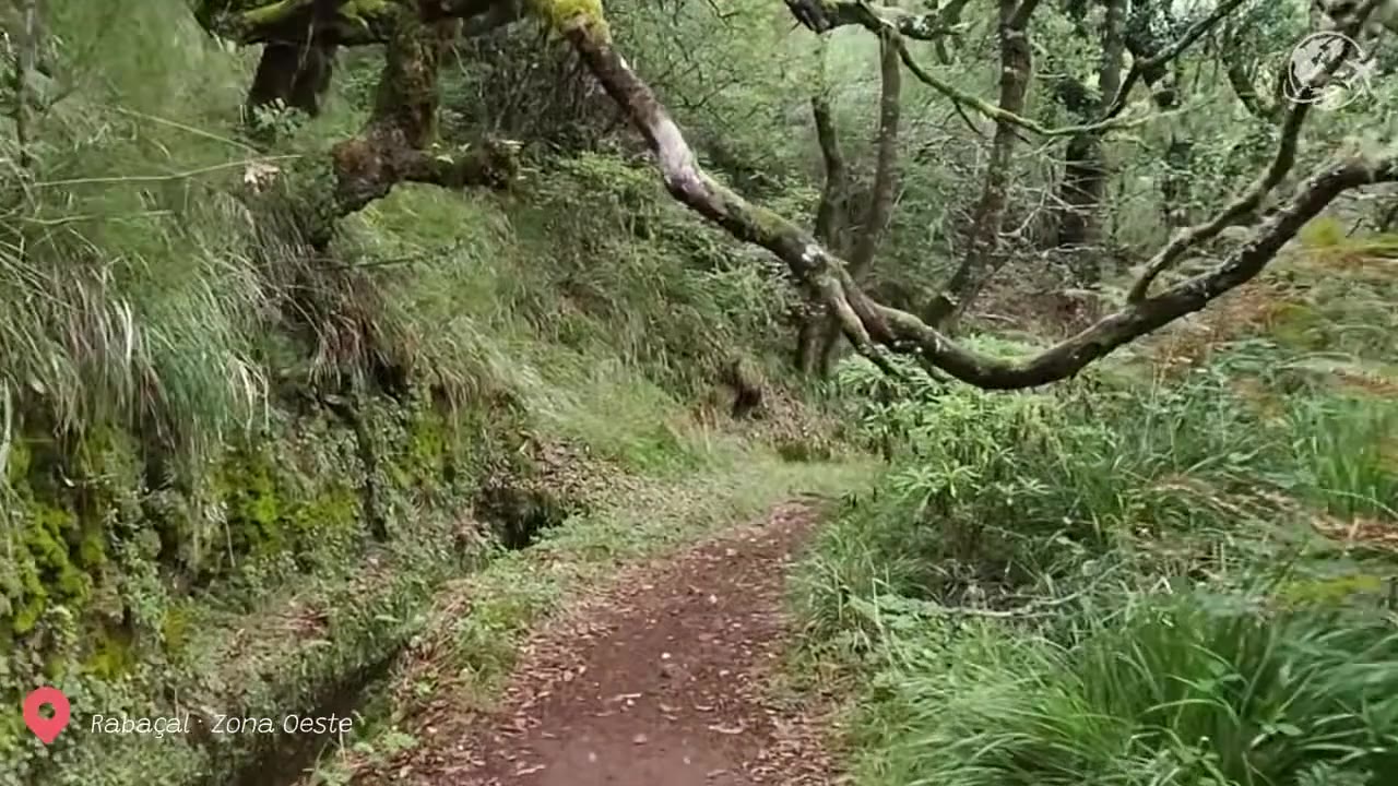
After the open upper section, the walk continues downhill towards Ribeira das Cales and the Ecological Park. The terrain is generally straightforward, but it remains uneven in places and can become slippery after rain. The official rating of “easy” refers to technical difficulty, not to the effect of descending several hundred metres on knees, ankles and tired legs.
How to get there and manage the one-way finish
Vereda do Burro is best approached by car or pre-arranged transport. Drive to Pico do Areeiro for the start, but remember that PR3 does not return to the summit: it ends at Ribeira das Cales. If you leave your own car at Pico do Areeiro, you will need a plan to collect it after the walk.
The simplest options are travelling with two vehicles, arranging a taxi or private transfer from the finish back to the summit, or joining a guided outing with transport included. Do not assume that a bus will conveniently connect the trailhead and finish on the timetable you need. Mobile coverage can also be inconsistent in the mountains, so organise the return journey before you begin.
Pico do Areeiro is heavily visited around sunrise. Parking fills quickly on clear mornings, and the paid parking charge can make an all-day return to collect your vehicle expensive. For this reason, PR3 works especially well as a point-to-point hike with a driver, transfer or two-car arrangement rather than as a casual walk from a parked rental car.
Fog, wind and suitability for newer hikers
For a fit beginner with sensible footwear, Vereda do Burro PR3 can be a good first mountain trail in Madeira. There are no technical climbing sections, and the route is considerably less intimidating than PR1. However, “easy” should not be mistaken for risk-free. You are starting above 1,800 metres, where weather can change quickly even when Funchal is sunny and warm.
Fog is the main practical issue. It can erase the views, make route-finding less comfortable and leave exposed ground damp and cold. Strong wind, heavy rain, thunderstorms or low visibility are all reasons to postpone. Check the official classified-walkway status on the morning of your hike, and respect any closure or restriction without attempting an unofficial detour.
Wear proper walking shoes with grip, carry water and food, and take a waterproof, windproof outer layer. Bring sun protection as well: cloud cover can clear rapidly, and high-altitude sun is stronger than many visitors expect. If you are uneasy on rough ground, recovering from injury, or travelling with very young children, choose a shorter low-level walk instead.
How to combine PR3 with nearby viewpoints
Begin with time at Pico do Areeiro itself. The summit area has broad views over Madeira’s central massif, and on exceptionally clear days you may see towards Ponta de São Lourenço, Curral das Freiras and Porto Santo. It is worth arriving before your trail booking or planned departure time, but only if the forecast gives a realistic chance of visibility.
Do not confuse PR3 with the famous PR1 route towards Pico Ruivo. They start in the same mountain area but offer completely different experiences. PR1 is a rugged ridge walk with major ascents and exposure; PR3 is the more forgiving downhill route to Ribeira das Cales. Walkers wanting a gentler mountain morning can visit the Pico do Areeiro viewpoints, then take PR3 rather than committing to the longer ridge traverse.
At the lower end, Ribeira das Cales is also the junction area for PR3.1, Caminho Real do Monte. Although it may be tempting to keep walking into Monte, only add another classified route if you have checked its current status, daylight, weather and transport arrangements.
- Start with a transport plan: PR3 is one way, so arrange collection from Ribeira das Cales before you park or set off.
- Check visibility, not only rain: a dry day can still bring dense fog and strong wind around Pico do Areeiro.
- Save the official confirmation and trail information offline: reception can be patchy once you leave the main road.
- Dress for two climates: expect cool, windy conditions at the start and milder temperatures as you descend.
- Protect your knees: walking poles are useful for the long descent, especially after rain or if you have sensitive joints.
- Do not pick plants or leave the trail: the high-altitude heath supports endemic flora that is easily disturbed.
Perguntas frequentes
Is Vereda do Burro PR3 suitable for beginners?
Yes, for reasonably fit beginners who are comfortable walking for nearly three hours on uneven ground. It is officially rated easy, but the sustained descent, exposed start and mountain weather mean it still requires proper preparation.
How long is Vereda do Burro PR3?
The official route is 7.2 km from Pico do Areeiro to the Funchal Ecological Park Welcome Centre at Ribeira das Cales, with an estimated walking time of around 2 hours 40 minutes.
Can I walk PR3 as a return hike?
You can physically turn around, but this would mean climbing back towards Pico do Areeiro and greatly increasing the effort. The route is designed and signposted as a linear descent, so most visitors arrange transport from the finish.
Do I need to book Vereda do Burro?
Madeira’s access rules for classified trails have changed in 2026. Check the official trail-status and reservation information before your visit, as entry arrangements and restrictions can be updated.
Facts and prices verified in October 2026. Before setting out, also read our practical guide to Pico do Areeiro parking, sunrise and weather, explore our selection of Madeira’s best sunrise and sunset viewpoints, and learn more about the island’s protected landscapes in our guide to Madeira’s largest protected areas.