Levada da Fajã da Nogueira is a demanding, beautifully remote waterfall walk in Madeira’s north-east, starting above Faial rather than Santo da Serra. It follows old water channels through deep Laurissilva forest, passing streams, mossy ravines and the dramatic Caldeirão do Inferno area before reaching Queimadas. In this updated guide: learn where the route really begins, which walking options make sense, how to arrange transport from Funchal, and how to prepare for mud, rain and wet tunnels.
What is the Levada da Fajã da Nogueira?
The Levada da Fajã da Nogueira is an old water-management route in the municipality of Santana, high above the north-coast parish of Faial. It should not be confused with a walk around Santo da Serra: these are separate parts of Madeira, and attempting to combine them in one day is impractical.
This is a wild, forest-led experience rather than a polished sightseeing trail. The route begins by the access road to the Fajã da Nogueira hydroelectric power station, then climbs into the island’s UNESCO-listed Laurissilva landscape. The official Santana Biosphere route description connects Fajã da Nogueira with Caldeirão do Inferno, Caldeirão Verde and Queimadas, crossing a remarkably wet and enclosed section of Madeira’s interior.
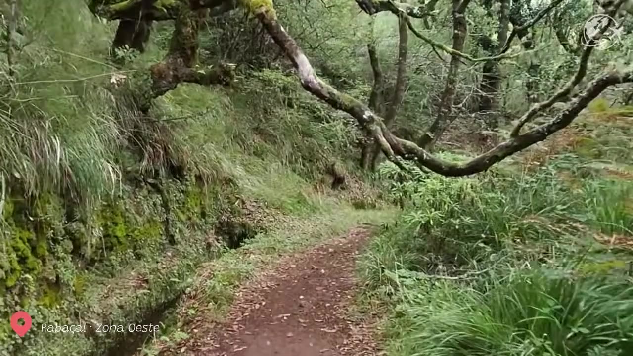
Expect a landscape of giant laurel trees, til and vinhático, dripping banks, narrow water channels and small waterfalls that are especially impressive after rain. Birdlife is part of the atmosphere too: listen for the Madeira firecrest and watch the canopy for the endemic trocaz pigeon.
For more background before you go, see our guide to Madeira’s Laurissilva UNESCO World Heritage landscape.
Choose the right route option
The full Fajã da Nogueira-to-Queimadas crossing is a serious point-to-point day walk, not a casual out-and-back levada stroll. Santana Biosphere lists it as a difficult 21 km route requiring around six to seven hours, with a substantial change in altitude. It is best for confident, well-equipped walkers who can navigate independently or who have arranged a guide.
Option 1: The full Fajã da Nogueira to Queimadas crossing. Start near the hydroelectric power station above Faial and finish at Queimadas Forest Park. This is the rewarding choice for experienced hikers: you gain the quieter forest approach before joining the better-known Caldeirão Verde and Caldeirão do Inferno landscape. Arrange a vehicle or taxi at the Queimadas end before setting out; do not assume that public transport will solve the return journey.
Option 2: Walk from Queimadas on PR 9. If you want the waterfalls and Laurissilva without the complex point-to-point logistics, use the official PR 9 Levada do Caldeirão Verde route from Queimadas. It is 17.4 km return to Caldeirão Verde and is the more straightforward independent option. The trail includes four rock tunnels, exposed levada sections and the waterfall plunging into the green pool at Caldeirão Verde.
Option 3: A guided through-walk. This is the sensible option if you specifically want to start at Fajã da Nogueira. A guide can manage vehicle transfers, route-finding, changing weather and the less obvious junctions between forest paths, levadas and the classified trail network.
Do not treat the Fajã da Nogueira section as an officially signed PR route in its own right. Conditions, vegetation growth and water flow can make informal shortcuts difficult to identify, particularly in fog or after heavy rain.
| Location | Above Faial, municipality of Santana, north-east Madeira |
| Full crossing | Fajã da Nogueira hydroelectric access road to Queimadas Forest Park |
| Full-route distance | 21 km |
| Estimated time | 6–7 hours |
| Difficulty | Difficult |
| Altitude range | Approximately 360 m to 1,100 m |
| Official alternative | PR 9 from Queimadas: 17.4 km return, around 6 hours 30 minutes |
| PR 9 access fee in 2026 | €4.50 for visitors aged over 12; advance registration is required through the official SIMplifica system |
| Queimadas parking | €2 per hour |
How to get there from Funchal
A hire car is by far the easiest way to walk Levada da Fajã da Nogueira. Drive east from Funchal on the VR1, continue towards Santana and Faial, then follow local roads uphill towards the hydroelectric access area. The final approach is rural and steep, so download offline maps before leaving the main road and avoid relying on mobile signal in the forest.
For the full crossing, use two cars or book a taxi transfer: leave one vehicle at Queimadas Forest Park and drive the other to the Fajã da Nogueira start. This removes the pressure of finding transport after a long, wet day on the trail.
Public transport is much more practical for reaching Santana or Santo da Serra than for accessing the hydroelectric starting point. From Funchal, SIGA route 651 serves Santo da Serra, but Santo da Serra is not a trailhead for this walk. If you are travelling without a car, choose PR 9 from Queimadas with a pre-arranged transfer, or join an organised hiking excursion rather than trying to piece together local buses mid-route.
Rain, mud and tunnels: what to expect on the ground
This is one of the wetter parts of Madeira. Rainfall feeds the forest, levadas and waterfalls that make the walk special, but it also creates mud, slippery stone, dripping vegetation and sudden shallow water across the path. Waterproof footwear with a grippy sole is essential; trail runners with worn tread are not enough for a wet day here.
Take a waterproof jacket even if Funchal is sunny. The north-facing interior has its own weather, and low cloud can arrive quickly. Pack a head torch for tunnels, preferably one that leaves both hands free, plus a spare battery or backup light. A phone torch is not a reliable replacement in a long, damp tunnel.
Some sections have a drop beside the levada or are narrow under overhanging rock. Move carefully, do not overtake on exposed edges, and never walk beneath a waterfall if there is active rockfall, strong runoff or an obvious erosion scar. After prolonged rain or a weather warning, choose another day.
Before travelling, check the current status of Madeira’s classified walking trails. PR 9 access and conditions can change because of weather, maintenance or safety work.
Pair it with Queimadas and Santana, not Santo da Serra
The natural companion to this walk is Santana. Finish at Queimadas Forest Park and allow time to see the traditional thatched-roof shelter there, then continue to Santana for food and a quieter look at the north-east of the island. This makes the day feel coherent: forest, waterfalls, historic irrigation and the rural highlands of Santana all belong to the same landscape.
Santo da Serra is worthwhile in its own right for its village atmosphere, weekend market and green upland setting, but it sits far to the south-east and should be treated as a separate excursion. If your itinerary includes both places, visit Santo da Serra on another day, perhaps while exploring Camacha, Machico or the eastern side of Madeira.
Walkers looking for another less-developed northern levada experience should also read our guide to the Levada do Jorge, while those preferring a gentler official route can consider Vereda do Burro (PR3).
- Start early: Forest cloud and afternoon rain are common, and a point-to-point walk takes longer than its distance suggests.
- Use waterproof boots: Expect muddy ground, slick stone and running water, particularly from autumn to spring.
- Carry a proper head torch: Tunnels are dark, wet and uneven; keep your hands free for balance.
- Organise the finish first: Confirm your Queimadas pickup or second car before beginning at Fajã da Nogueira.
- Check PR 9 registration: If your route enters the classified Caldeirão Verde section, book and pay through SIMplifica in advance.
- Do not chase waterfalls in storms: Turn back if water is crossing the path forcefully or visibility becomes poor.
Frequently asked questions
Is Levada da Fajã da Nogueira near Santo da Serra?
No. The route starts above Faial in Santana municipality, on Madeira’s north-east side. Santo da Serra is a separate upland village further south-east and is not a practical trailhead for this hike.
How difficult is Levada da Fajã da Nogueira?
The complete Fajã da Nogueira to Queimadas route is difficult because of its 21 km length, changing altitude, wet terrain and point-to-point logistics. It is better suited to experienced hikers than first-time levada walkers.
Do I need to pay to walk it?
The Fajã da Nogueira approach is not listed as a standalone classified PR walk. However, the route connects with the PR 9 Caldeirão Verde area, where visitors over 12 must register in advance and pay the 2026 individual-trail fee of €4.50.
Can I do the walk in trainers?
It is not recommended. Wear waterproof hiking boots or robust trail shoes with deep grip, as mud, wet stone, tunnels and water crossings can make the route slippery.
Facts and prices verified in October 2026. Trail conditions can change rapidly after rain, so always confirm the official status before leaving. For more route planning, explore our guides to Madeira’s largest forests, Madeira’s oldest levadas and the Hiking & Levadas category.