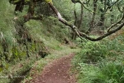
Madeira has no single official count of individual levadas, but its water-channel network totals about 3,100 kilometres when primary and secondary waterways are included. That impressive figure explains why answers to “how many levadas in Madeira?” often vary: some sources count only main channels, while others include private, public and smaller irrigation branches. In this updated guide: learn what a levada is, how the official figures fit together, which historic channels matter most, and which named levada walks are currently available to hikers.
How many levadas are there in Madeira, exactly?
The honest answer is that there is no fixed, officially published total number of separate levadas. Madeira’s system developed gradually from the fifteenth century onwards, with public works, private channels, shared agricultural waterways and smaller distribution channels added over several centuries.
For that reason, the most reliable way to measure the scale of Madeira’s levadas is by total length rather than number. The official documentation submitted to UNESCO describes around 3,100 km of waterways when primary public, secondary public and primary private channels are counted together. Within that total, the principal public and private levadas account for approximately 800 km.
This distinction matters. A long main levada may feed numerous short irrigation channels running down through terraces, banana plantations and vineyards. Counting each branch separately produces a much higher number than counting only the main watercourses. Portugal’s national tourism authority uses the simpler visitor-friendly estimate of “about 3,000 km”, which is consistent with the wider 3,100 km network figure.
Levadas were designed to move water by gravity from Madeira’s wetter mountains and north-facing slopes towards farms, homes and hydroelectric infrastructure. Their narrow maintenance paths later became walking routes, but they remain working water systems rather than a purpose-built hiking network.
The key levada figures at a glance
| Practical fact | Verified detail |
|---|---|
| Total levada and irrigation-waterway network | About 3,100 km, including primary public, secondary public and primary private waterways |
| Main public and private waterways | Approximately 800 km |
| Origins of the system | First quarter of the 15th century, following Madeira’s settlement |
| First publicly financed levada | Levada Velha do Rabaçal; work began in 1835 and was completed in 1860 |
| Official named levada PR routes on Madeira Island | 15 routes in the current classified-trails list |
| Standard 2026 access fee for most classified trails | €4.50 per visitor aged over 12, subject to the route and booking conditions |
| How to check access | Reserve and confirm the live route status through the regional IFCN/SIMplifica system before travelling |
The 3,100 km figure should not be read as 3,100 km of continuous, signposted hiking path. Some channels run beside private land, pass through operational infrastructure, cross exposed terrain or have no safe public access. The walkable network is therefore much smaller and changes with maintenance, weather damage and conservation work.
What are the oldest and longest levadas in Madeira?
Madeira’s first levadas date from the fifteenth century, when settlers needed a reliable way to bring mountain water to sugar-cane fields, mills and later vineyards. The earliest channels were relatively short and simple, sometimes cut into volcanic rock and sometimes made with wooden trough sections. Many have been rebuilt, enlarged or incorporated into later systems, so naming one surviving channel as the island’s single oldest levada is not straightforward.
For visitors, Levada do Furado is especially significant. Official tourism information describes it as one of Madeira’s oldest levadas, and today’s PR10 walk between Ribeiro Frio and Portela follows part of this historic water route through Laurissilva forest. It is a better example of levada heritage than a claim to an unverified “oldest” title.
The clearest historic record belongs to Levada Velha do Rabaçal: it was the first levada to receive public funding, with construction beginning in 1835 and finishing in 1860. Its route is now recognised as PR6.4, a quieter alternative in the Rabaçal area.
There is also no current official visitor source that definitively ranks every levada by full engineered length. Several large twentieth-century systems cross long distances and include branches, tunnels and related infrastructure, making comparisons difficult. The important point for walkers is that the island’s longest waterworks are not necessarily its best or safest hikes. A classic marked route may use only a short section of a much longer levada.
How many levada walks are officially walkable in 2026?
On Madeira Island, the regional classified-trails list currently includes 15 named routes whose titles include “Levada”. These are PR4 Levada do Barreiro; PR6 Levada das 25 Fontes; PR6.1 Levada do Risco; PR6.2 Levada do Alecrim; PR6.4 Levada Velha do Rabaçal; PR6.8 Levada do Paul II; PR7 Levada do Moinho; PR9 Levada do Caldeirão Verde; PR9.1 Levada do Caldeirão Verde – Um Caminho para Todos; PR10 Levada do Furado; PR14 Levada dos Cedros; PR16 Levada Fajã do Rodrigues; PR18 Levada do Rei; PR23 Levada da Azenha; and PR28 Levada da Rocha Vermelha.
At the September 2026 check, 13 of those 15 routes had either open or partially passable status. PR7 Levada do Moinho and PR28 Levada da Rocha Vermelha were listed as closed, while PR4 Levada do Barreiro was only partially passable. These statuses can change quickly after heavy rain, landslides, forestry work or fire-risk restrictions, so treat the number as a snapshot rather than a promise.
All classified routes now require advance registration through the official system, including visitors who are exempt from payment. For non-resident visitors aged over 12, the usual individual-route fee in 2026 is €4.50, except for the different PR1 Areeiro pricing structure. Before setting out, read our guide to Madeira hiking trail closures and fees and check the live listing on the official IFCN classified trails page.
The most famous levadas to walk
For a first levada experience, the best-known walks are famous for good reason. PR6 Levada das 25 Fontes leads into the lush Rabaçal valley and finishes at a spring-fed lagoon; expect controlled one-way walking arrangements and busy periods. Nearby PR6.1 Levada do Risco is a shorter route to the viewpoint for the island’s dramatic Risco waterfall.
PR9 Levada do Caldeirão Verde is Madeira’s classic forest-and-tunnel adventure, starting at Queimadas and passing waterfalls before reaching its green amphitheatre. Bring a torch or headlamp, because its rock tunnels are dark and wet. PR10 Levada do Furado is a more historic, varied crossing from Ribeiro Frio towards Portela, while PR18 Levada do Rei offers deep vegetation and the attractive Ribeiro Bonito valley near São Jorge.
For a gentler woodland option, PR14 is one of the island’s most rewarding routes; see our full guide to Levada do Cedros near Fanal. It is a good choice for walkers who want Laurissilva atmosphere without committing to the crowds and long day of Caldeirão Verde.
- Do not count every water channel as a trail: many levadas are operational, private or unsuitable for public walking.
- Book before you drive: access slots and closures are managed through the official reservation system.
- Carry a proper light: a phone torch is not enough for long, wet tunnels such as those on PR9.
- Respect the channel edge: do not step into the water or block maintenance access.
- Start early on popular routes: Rabaçal and Queimadas are far quieter in the morning.
- Choose the route, not the record: distance, exposure, tunnels and return transport matter more than whether a levada is historically long.
Frequently asked questions
Are there 2,000 or 3,000 km of levadas in Madeira?
The difference usually comes from what is being counted. Official heritage documentation gives about 3,100 km when the wider irrigation network is included, while approximately 800 km refers to the main public and private waterways.
What is the oldest levada in Madeira?
Levadas began in the fifteenth century, but there is no simple official ranking for the oldest surviving named channel. Levada do Furado is recognised as one of the oldest, while Levada Velha do Rabaçal was the first to receive public funding in 1835.
Can you walk along every levada in Madeira?
No. Only selected sections are public walking routes. Many channels are private, inaccessible, unsafe, used for water management or temporarily closed for maintenance and weather-related repairs.
Do you pay to walk Madeira’s levadas?
Most classified walking routes have a 2026 fee of €4.50 for non-resident visitors over 12, with registration required in advance. Some routes and visitor categories have different conditions, so always confirm the official booking page.
Facts and prices verified in September 2026. For more route planning, explore our guides to Ribeira da Janela (PR15), Vereda das Funduras (PR5) and the wider Madeira Hiking & Levadas collection.