The Encumeada Madeira viewpoint is one of the island’s best short mountain stops, offering a rare chance to look towards both the north and south sides of Madeira from a 1,007-metre pass. This is not a polished attraction with a timed visit: it is a dramatic roadside pause in the central mountains, where valleys, ridges and cloud layers can change by the minute. In this updated guide: what you can see, where to park, which walks start nearby, how to judge the weather and how to drive the pass safely.
Why stop at the Encumeada Madeira viewpoint?
Encumeada, also called Boca da Encumeada, sits on the mountain ridge separating the Ribeira Brava and Serra de Água area on the south side from the São Vicente valley to the north. On a clear day, the viewpoint gives a revealing sense of Madeira’s geography: steep, densely green slopes fall away on either side, while the central mountain chain rises behind them.
The main viewpoint is worthwhile even if you do not intend to hike. Allow time to step away from the car, look in both directions and wait for breaks in the cloud. The south-facing side looks down towards the deep Ribeira Brava valley; the north-facing side is wilder and greener, running towards São Vicente. It is a particularly good addition to a driving day linking Ribeira Brava, São Vicente, Paul da Serra or the north coast.
Do not expect a large visitor centre or a long promenade. Encumeada is best approached as a brief, atmospheric mountain-pass stop, with the real reward being the scale of the landscape and the fast-changing conditions.
| Practical fact | What to know |
|---|---|
| Location | Central Madeira, on the mountain pass between the south and north sides of the island |
| Altitude | 1,007 metres |
| Recommended visit time | 20–40 minutes for the viewpoint; longer if combining it with a walk |
| Parking | Small roadside parking and pull-in spaces beside the viewpoint area; capacity is limited |
| Best access | By hire car, taxi or organised island tour; use “Miradouro da Encumeada” in your navigation app |
| PR 21 Caminho do Norte | 3.2 km downhill route from Encumeada to Ribeira Grande; moderate difficulty; about 1 hour 30 minutes |
| Classified trail access fee | €4.50 for visitors over 12 on PR 21, booked through the official SIMplifica platform; children aged 12 and under are exempt |
How to get there, park and drive the pass safely
The most scenic approach is on the old mountain road between Serra de Água and São Vicente rather than simply passing beneath the mountains via the expressway tunnel. From the south, the road climbs steadily from the Serra de Água valley through a sequence of bends; from the north, it rises from São Vicente through wetter, more heavily forested scenery.
Set your navigation destination specifically to Miradouro da Encumeada. The pass is at the meeting point of several mountain roads, so entering only “Encumeada” can send you towards accommodation, trails or a different section of road. The viewpoint itself is directly beside the road, with a small parking area and informal pull-in spaces nearby.
Park only where your vehicle is fully off the carriageway. This is a working mountain road used by local traffic, coaches and larger vehicles, and stopping on a blind bend is dangerous. If the closest spaces are full, continue carefully until you find a legal place to turn or park rather than squeezing into the roadside verge.
The route is suitable for confident drivers, but it is not the place to rush. Expect narrow sections, tight bends, damp patches and reduced visibility in cloud. Descend in a low gear rather than relying continuously on the brakes, keep well to your side of the lane and use headlights when mist becomes dense. Before setting out, check the official regional road information, particularly after heavy rain, high winds or a period of maintenance works.
Walks from Encumeada: choose a route, not a casual wander
Encumeada is a genuine walking hub, but the surrounding terrain is serious mountain country. Do not set off along a signed trail without checking its live status, arranging transport for point-to-point routes and taking waterproof layers, food, water and a charged phone.
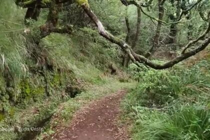
PR 21 Caminho do Norte is the most practical official walk beginning at Boca da Encumeada. This 3.2-km route descends from about 1,000 metres to Ribeira Grande and is graded moderate, with an estimated walking time of 1 hour 30 minutes. It begins through Laurissilva forest, then continues downhill towards the north coast. It is not a circular walk, so organise a pick-up or taxi from the finish before you begin. The current official charge for classified walking routes is €4.50 for visitors over 12, payable through the SIMplifica platform.
PR 17 Caminho do Pináculo e Folhadal is for experienced, prepared walkers rather than viewpoint visitors looking for a short stroll. The full route is 15 km, graded difficult and estimated at 6 hours 30 minutes. It runs through high-altitude landscapes, levada sections, tunnels and Laurissilva forest. Its permitted sections can change, so read our guide to the Levada do Pináculo e Folhadal (PR17) and confirm the official trail notice on the day.
The long PR 1.3 Vereda da Encumeada route traditionally links Pico Ruivo and Encumeada, but the section between Boca das Torrinhas and Encumeada remains closed in October 2026. It must not be used as an access route to the pass until the authorities announce a full reopening.
Encumeada weather: when cloud can erase the view
At 1,007 metres, Encumeada has its own weather pattern. A bright morning in Funchal, Ribeira Brava or São Vicente does not guarantee a clear pass. Low cloud can pour over the ridge, rain can arrive suddenly and the temperature can feel markedly cooler than at sea level.
For the widest views, aim for a day with a clear mountain forecast and keep your itinerary flexible. Mornings often offer a better chance of clearer conditions, but there is no fixed rule: cloud can lift later in the day, while a perfectly open pass can close in within minutes. If the viewpoint is completely engulfed in mist, wait briefly before leaving; passing cloud sometimes reveals the valleys in dramatic intervals.
Visibility matters more here than sunshine. Even on a dry day, bring a windproof layer and wear shoes with grip if you plan to leave the paved roadside. In wet weather, avoid treating unmarked paths or roadside banks as viewpoints: the ground can be slippery and edges are not always protected.
- Use the viewpoint as a flexible stop: build it into a driving route rather than making it your only destination for the day.
- Take a warm layer: the pass can feel cool and windy even when coastal towns are warm.
- Photograph both sides: the south-facing Ribeira Brava valley and the north-facing São Vicente side have very different light and cloud conditions.
- Do not rely on mobile signal: download your route and trail information before entering the mountains.
- Book trail access before walking: official classified routes require registration and payment where applicable.
- Keep driving after the viewpoint: the changing scenery between Encumeada, Serra de Água and São Vicente is part of the experience.
Frequently asked questions
Is the Encumeada Madeira viewpoint worth visiting?
Yes. It is one of Madeira’s most revealing mountain viewpoints because it looks across the island’s central ridge towards both the north and south sides. It is especially worthwhile if you are already driving between Ribeira Brava, São Vicente or Paul da Serra.
How long should I spend at Encumeada?
Allow around 20 to 40 minutes for the viewpoint itself. Add more time if you want to wait for cloud to clear, take photographs or begin an official walking route.
Can I walk from Encumeada to São Vicente?
PR 21 Caminho do Norte begins at Encumeada and descends towards Ribeira Grande, on the north side of the island. It is a one-way route, so arrange onward transport and check the official route status before starting.
Is the road to Encumeada difficult to drive?
The pass road has bends, steep gradients and frequent mist, but it is manageable for careful, confident drivers. Drive slowly, avoid stopping on bends and choose another route if visibility becomes poor or road conditions are affected by severe weather.
Facts and prices verified in October 2026. For more high-altitude route ideas, see our guide to Vereda do Burro (PR3); for background on the forest you encounter around the pass, read Madeira’s Laurissilva UNESCO heritage status; and for more scenic mountain driving, explore Madeira’s highest roads.